New Zealand has thousands of kilometers of hiking trails, including the famous Great Walks. Marlborough Sounds is home to the Queen Charlotte Track, running almost the entire length of New Zealand’s Queen Charlotte Sound. This track is a long track (73 1/2 km one way), and it is full of coastal views, native bush and, of course, the Sounds themselves.
While there are short hikes on the QC track that come close to the drive out to St Omer Hide Away, for the most part it will be more convenient just to do short walks in the area if staying in St Omer.
Following are descriptions of local walks in our area, presented in order of increasing difficulty.
Walk along St Omer Road or Kenepuru Road
By the time you reach our area you are close to the end of any roads, paved or otherwise, so there’s generally not much car or truck traffic on the road.
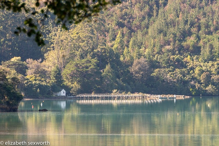
St Omer Road starts right at the bottom of our driveway. The public portion of this gravel road leads to the St Omer Jetty and beach and then becomes a private road a little further on. However, if you round the bend at the bottom of our driveway and take Kenepuru Road on foot, you’ll walk past a farm on your right, followed by the Nopera golf course and have lovely views of the bay on your left.
This route is quite flat with only a modest slope here or there.
Skiddaw Farm & Scenic Reserve
I estimate that this is about 8 kms from St Omer Hide Away. It’s probably about 5 kms to Raetihi, then another 2 kms to Hopewell and the walk starts at the end of the road behind Hopewell.
See the map and photos.
It is well marked once you park the car and start walking.
You’ll reach a “Y” in the road and the Hopewell Loop Track goes off to the right and the track to Skiddaw goes straight (or to the left of the Y).
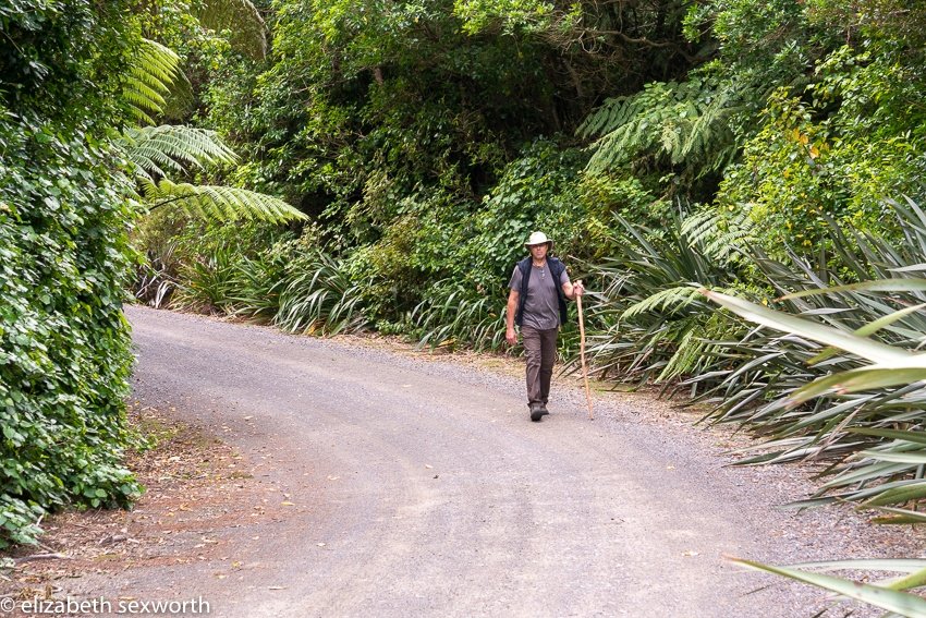
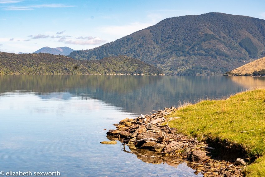
There are sunny sections, sections full of beech trees, and sections full of tree ferns. At the end you’ll come to a gate that marks the entrance to Skiddaw Farm. The owners request that you not enter the pasture but instead walk along the fence line down to the water’s edge.
If the tide is out there may be a beach of sorts that you can walk on, but in a very high tide you’ll be stuck right there at land’s edge, where native bush comes right down to meet water’s edge. By stuck I mean with the water in front of you, thick bush to your left and a fence to your right. My understanding is that the forest there is native bush that has never been milled.
This is an easy walk with only slight elevation changes.
Panorama Road (aka “Road to the cell towers”)
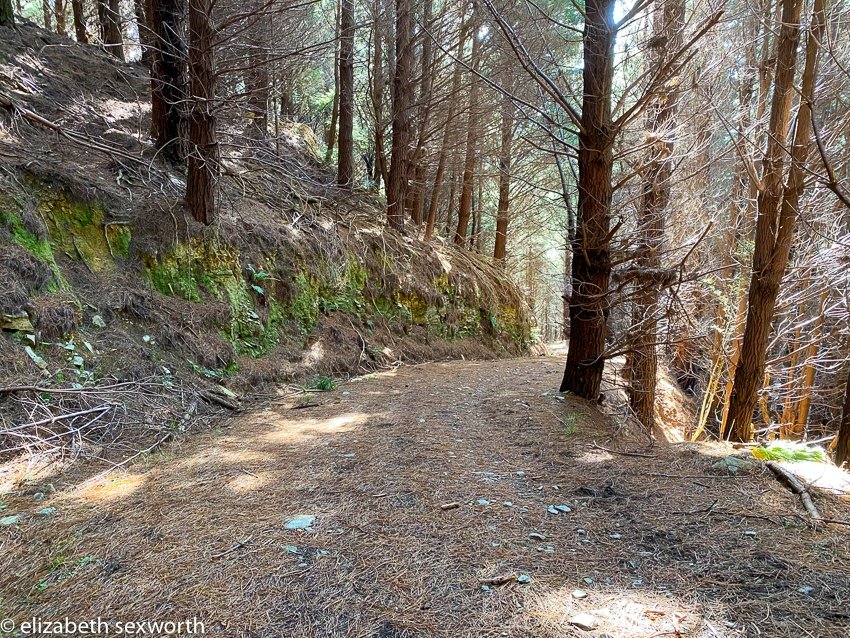
Sadly, Panorama Road is not the official road name and you won’t find it on any map. I’m not sure the road has a name, actually. This is not an easy road, as it is up, up, up. Then up some more. However, the road is well-maintained and you’ll be climbing through a pine forest and almost exclusively in shade until you reach the top. So just take your time. (Sort of like walking up our driveway…)
Once you think you’re at the top, you’re really not, but you’ll see a small road that goes off to the left and off over towards another ridge.
This is not your road.
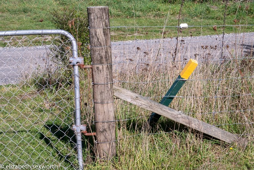
You’ll want to continue on the road to the right. To get the views you’ll need to go further and climb over a gate or go through a fence that you’ll come to.
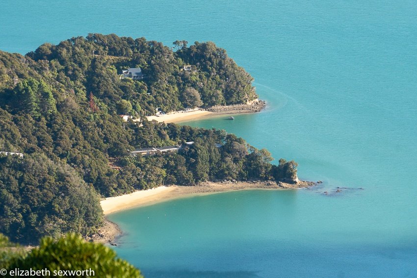
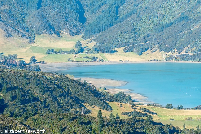
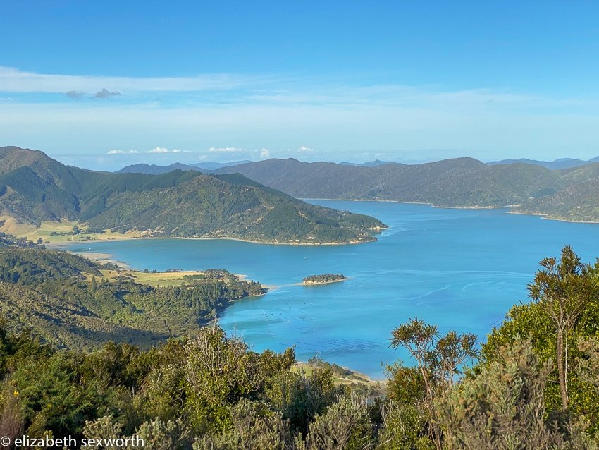
Alternatively, you may be able to walk around this fenced section on the left side of it, but there’s no trail so bring a stick and of course have good walking shoes. If you go the through the fence route, there’s one final gate to keep the sheep and goats where they’re supposed to be (or not be) and then you’ll be up by the towers. Whereupon you are rewarded with views of Kenepuru Sound and Waitaria Bay. Choose a good weather day with clear skies or scattered clouds to really get the best views. Or perhaps a super moody weather day if that floats your boat.
This is a steep walk but on a good road and may take about an hour to get up.
Take Kenepuru Road past the golf course and turn right on Crail Bay Road. After a short climb up the hill and around a few turns, you’ll see an open area on the right side of the road that looks like it could be a parking lot with some long-ago gravel piles. Turn right into this parking area, being careful to check first to make sure another car is not coming around the corner as it is quite a blind turn there. You can reach the walking/4WD road from the parking area directly or you can walk out to Crail Bay road a few feet and you’ll see a separate gated entrance to the 4WD road just to your right.
Hopewell Loop Track
This is probably the most difficult walk you can do within a short drive from St Omer Hide Away. Wear very good shoes and perhaps wait a few days if it has recently rained.
It may be a better hike in summer or very early fall so that the sun is more overhead and shining on all parts of the track at least part of the day. We did this track in mid-April and parts were very slick with wet clay, moss and algae.
Hiking poles or walking sticks are a must, and preferably two of them if it is wet and slick. It might not be a problem if it has been dry.
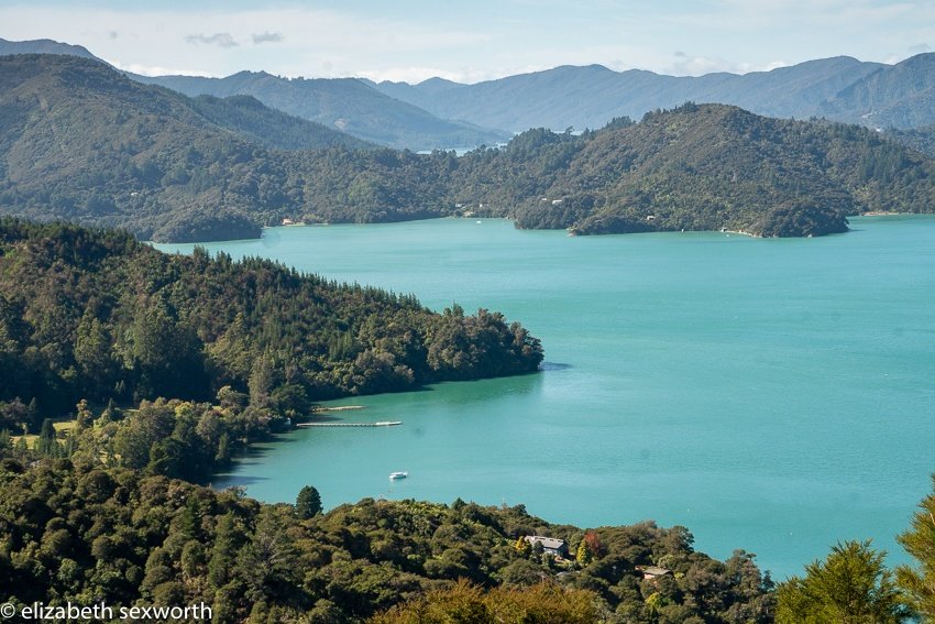
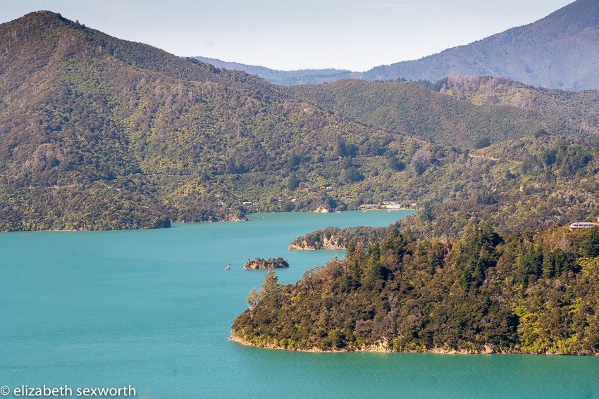
There are green and yellow DOC-type poles marking the path, mostly in the places you need them. About half way through the walk you’ll come to a fairly flat, cleared section with some great views of Kenepuru Sound. You can see Te Mahia, Portage and St Omer Bay.
This track will have gorse, some stumps and roots but it is fairly well maintained for a voluntary track. We are very grateful to Hopewell’s owners, Mike and Lynley, for their work in maintaining the track.
Note: there’s about an 800 foot elevation change on this walk although not a lot of up and down. So it is mostly up on the first section, and then down on the return. And, on the final stretch after you’ve finished coming down, you’ll go through a beautiful treed section with Manuka and tree ferns and then onto a gravel road where you’ll feel like you are walking on someone’s private property.
Well you are, but that’s ok and just make certain you close the gate when you reach Kenepuru Road.
You’ll see the final green/yellow DOC-type track marker and know that, yes, you did indeed take the right path out! From there turn right and walk the short distance along Kenepuru Road back to the Hopewell car park area.